Day 8: Myra Canyon – Penticton
in Uncategorized
Total Distance Travelled: 85KM (20 KM backtrack)
Total Distance Travelled Entire Trip: 402KM
Total Time: 6:56
Moving Time: 5:07
It was finally time to leave the B&B far above the Okanagan and officially enter the valley by bike. Luckily my hosts gave me a ride back up to the trail so I didn’t have to tackle the 12% grades to get back on the trail. I really wanted to see Myra canyon one more time, so I backtracked 10KM down the trail and crossed most of the trestles again before turning back towards Penticton. Entering from the East side is definitely more impressive, the views open up more quickly and the trestles are closer to the entrance of the park than on the west side. Given the weather was much improved today, there were many more people on the trestles – both local cyclists and hikers.
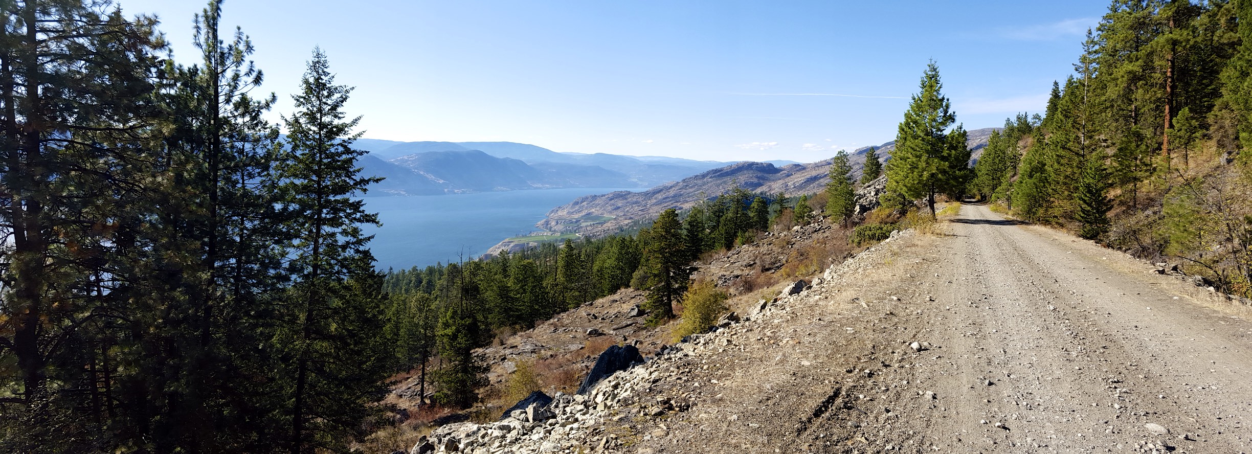
Today is a big descent day, given Penticton is at 385M. That makes for a drop of nearly 800M, and should make for an easy day. However this stretch of the trail is the single worst section I have seen to date. Deep potholes with washboard and sandy sections made for quite an obstacle course. The trail is a road for vehicles, ATV’s and cyclists which explains much of the poor conditions. The first 25KM from Myra is the worst, and the trail steadily improves from there until you get to approximately the last 20KM which is closed to all vehicles.
The views as you descend of Okanagan Lake our outstanding, despite the rough trail.
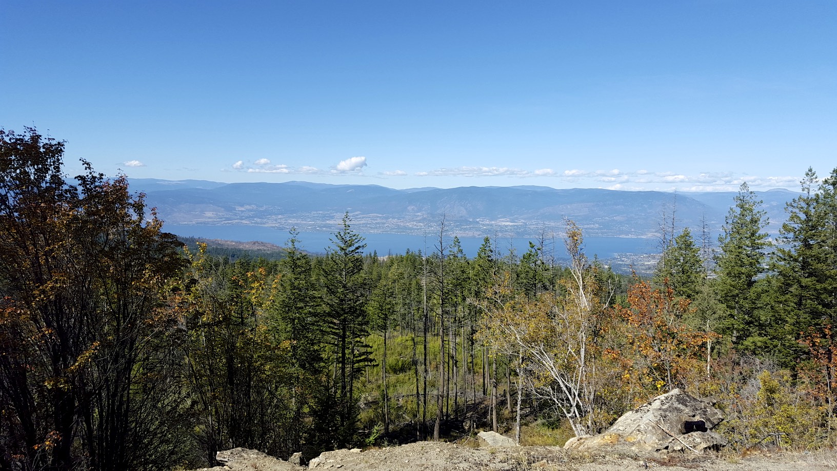
High above the lake
As the trail continues, there is still another spectacular trestle bridge:
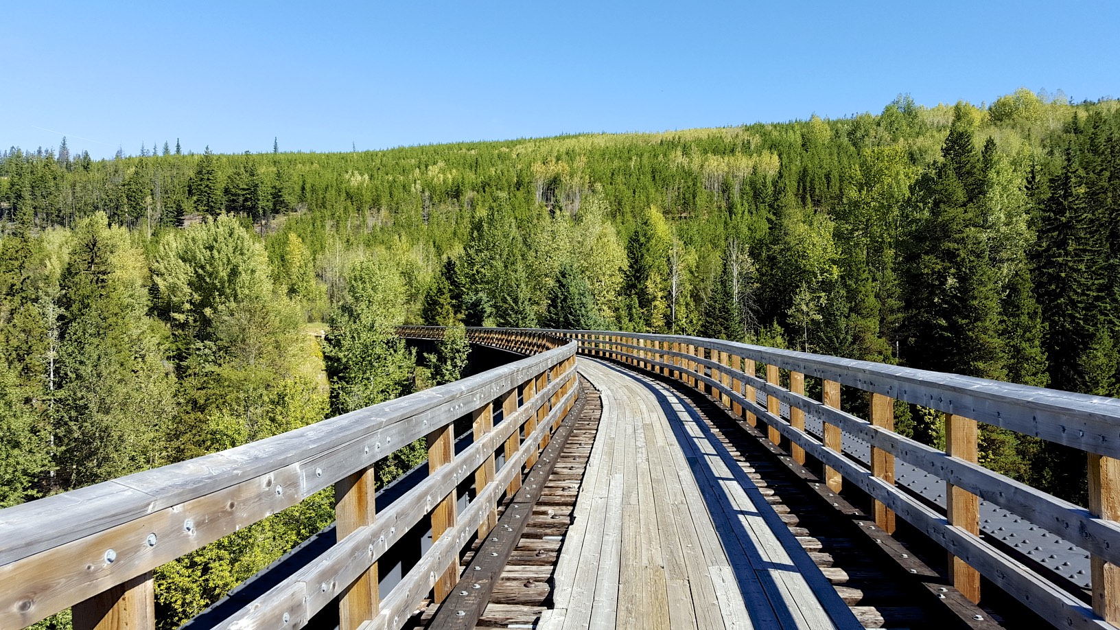
Trestle
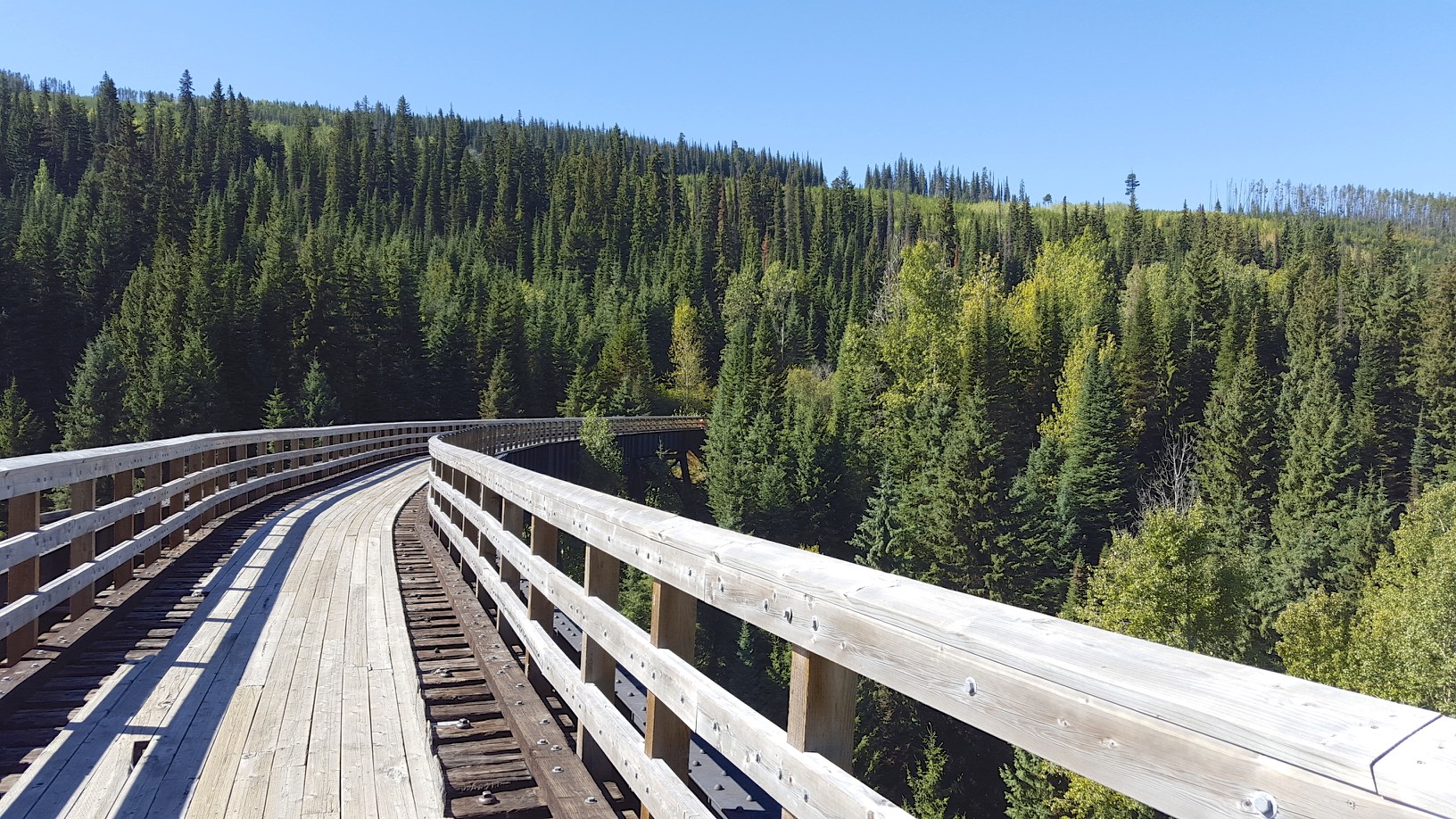
View from the other side
Some impressive engineering went into the line to keep the grade reasonable despite having to descend 800M. The trail loops back on itself multiple times as it works its way down the mountain side. Originally a spiral tunnel was created to connect the segments, but it’s unfortunately closed. The first 100M of it is available for hiking though.
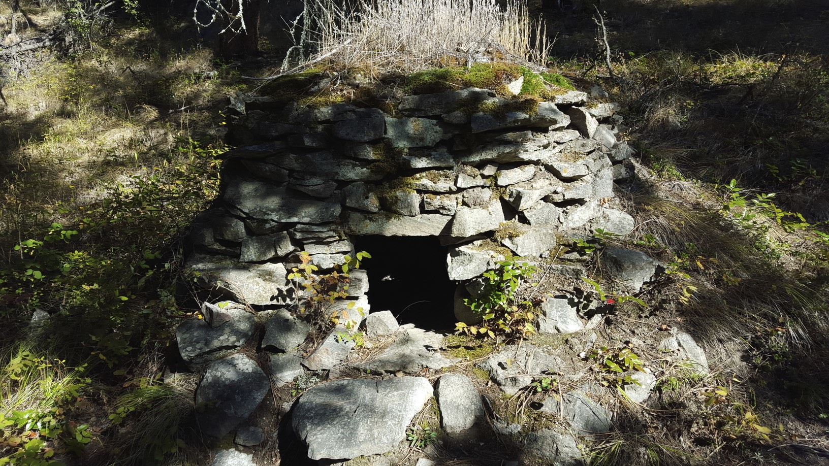
As the trail descends it enters Rock Oven provincial park, these rock ovens were created by Italian stone masons to cook fresh bread for the railway workers.
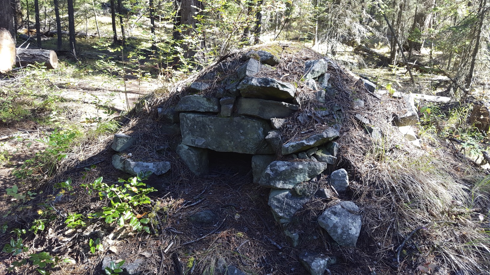
Rock oven
Rock Oven
It’s incredible that these rock ovens are over a 100 years old, yet they are still in excellent condition. According to the park information, they are still in usable condition and you could easily cook bread in them again. The rock ovens were built all over the line, but the greatest concentration of them is in Rock Oven provincial park.
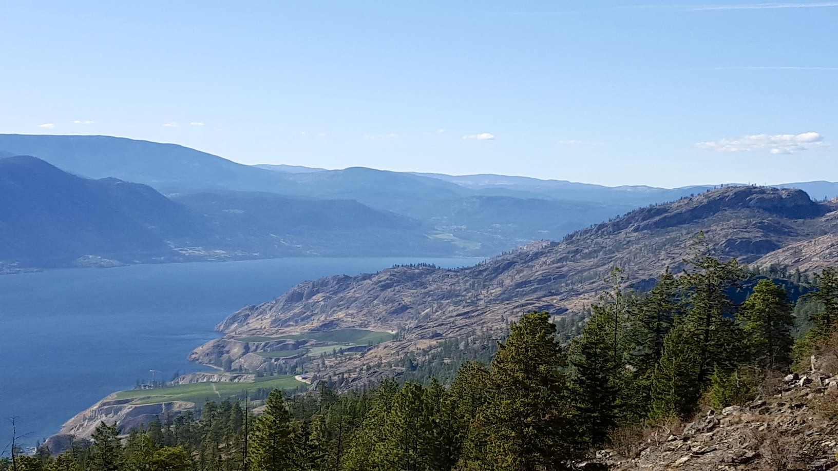
Past the park, views of the lake open up again:
Another lake view
The landscape changes drastically as you descend, the valley is in the rain shadow of the mountains so trees become rarer and the land starts to resemble more of a desert with green spots where the land is being farmed. 55% of all the water in the Okanagan is used for agriculture, with another 20% being used by residents. This year has been particularly dry which has lead to more severe forest fires and water restrictions throughout the valley. The odd/even house number watering restrictions were in effect for most cities and residents were encouraged to conserve water. Just like in California, you use quite a bit of water trying to farm the desert.
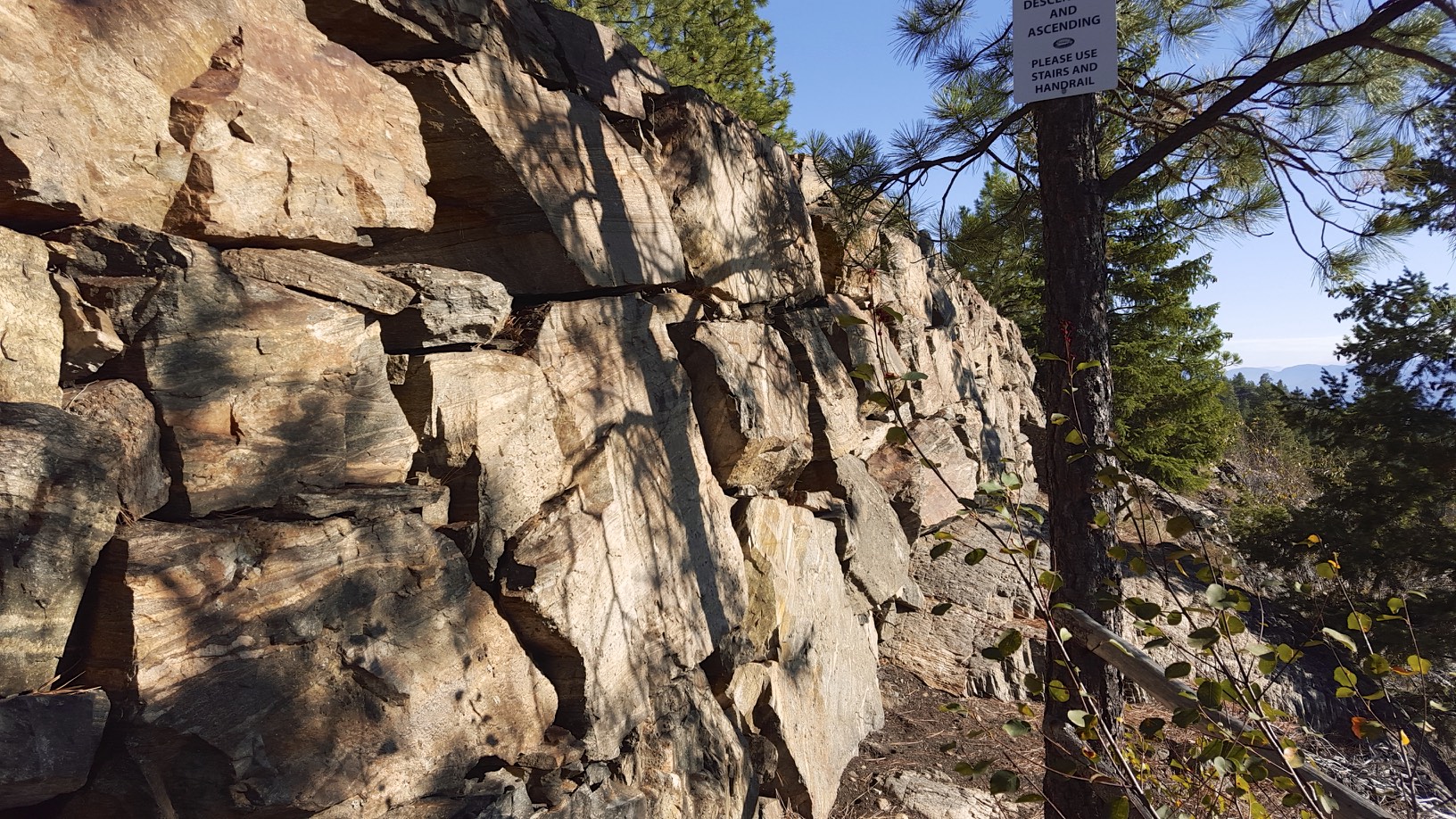
Italian stone mason wall
Continuing down the trail, there is a spot where you can inspect the work done by Italian stone masons when the line was built. These rock walls do not use mortar, and have stayed together for over a 100 years. Even with the tracks gone, the impressive engineering of the whole line remains.
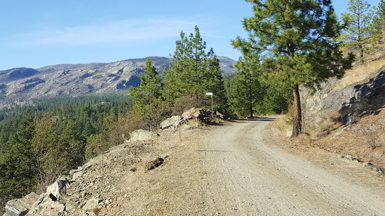
Mile markers (mile 121)
One neat thing that was preserved were the CPR mileage markers on this section of trail, in this case indicating mile 121 of the Carmi subdivision which runs from Midway to Penticton – e.g. this point is 121 miles away from Midway since mileage markers go up from east to west.
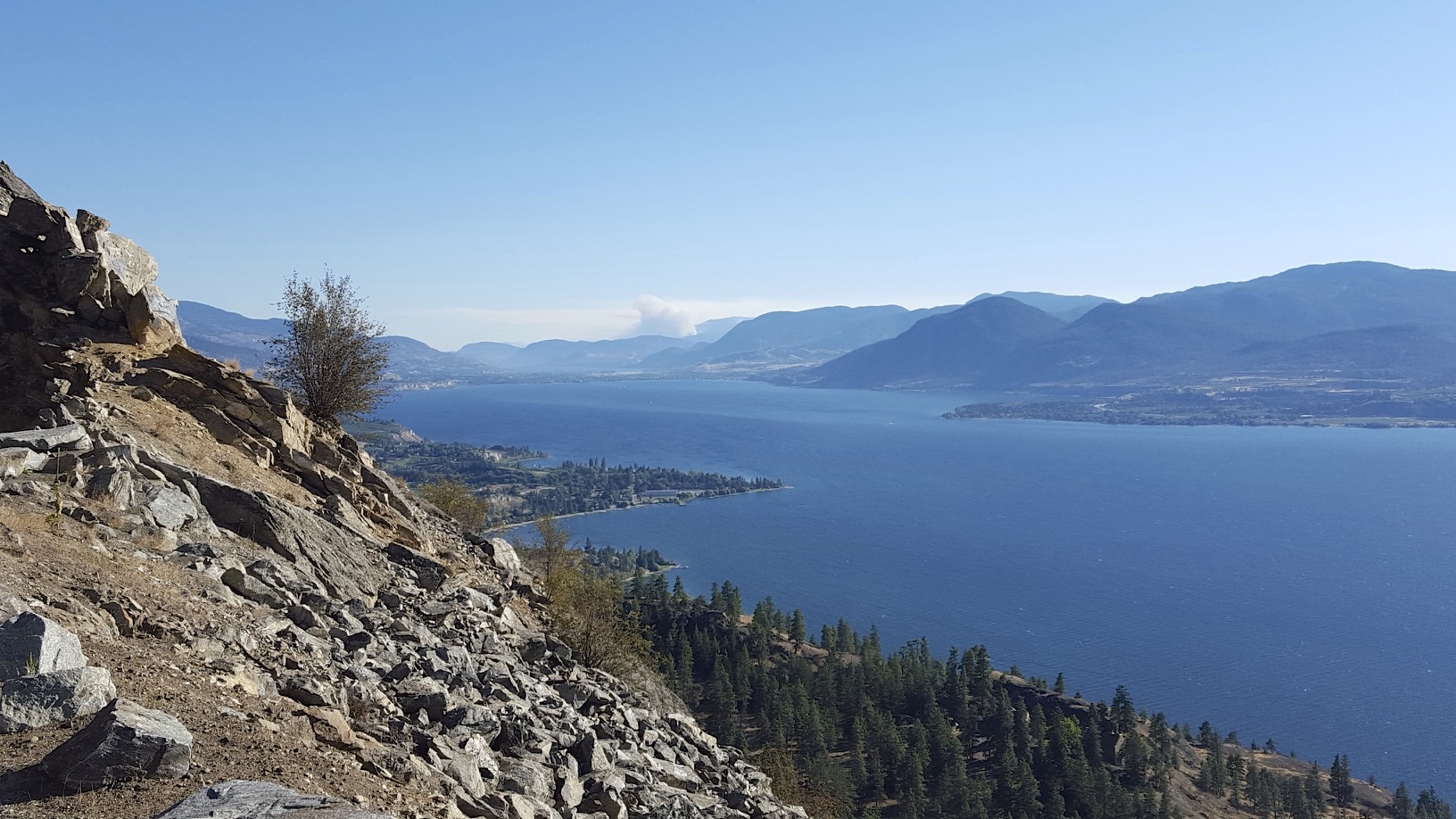
The lake gets closer….
Eventually the trail becomes paved near the little tunnel which is nice break from the rough trail surface earlier.
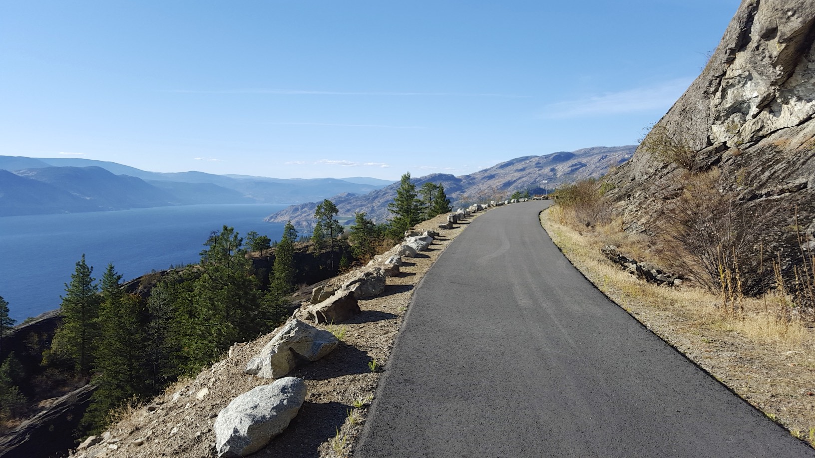
Paved trail!
Eventually the trail starts getting into the agricultural part of the valley, with wineries and orchards covering the hill side.
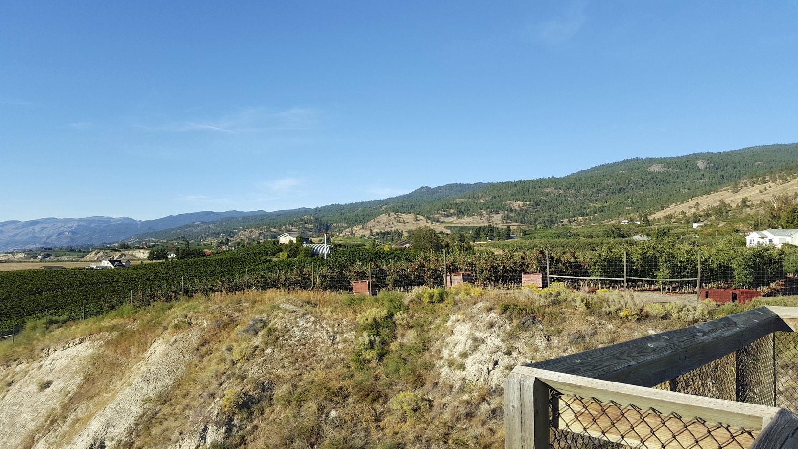
Back to civilization
I headed to my B&B in Penticton which was ironically located on Winnipeg st. It was time for some well deserved Indian food. After dinner, I walked down to the lake and caught the last bit of sunset.

Sunset