Day 5: Midway – Beaverdell
in Uncategorized
Total Distance Travelled: 71KM
Total Distance Travelled Entire Trip: 252KM
Total Time: 5:36
Moving Time: 4:09
Another great cycling day with good weather. Although it was Labour Day, I was happy to see the Midway museum was open.
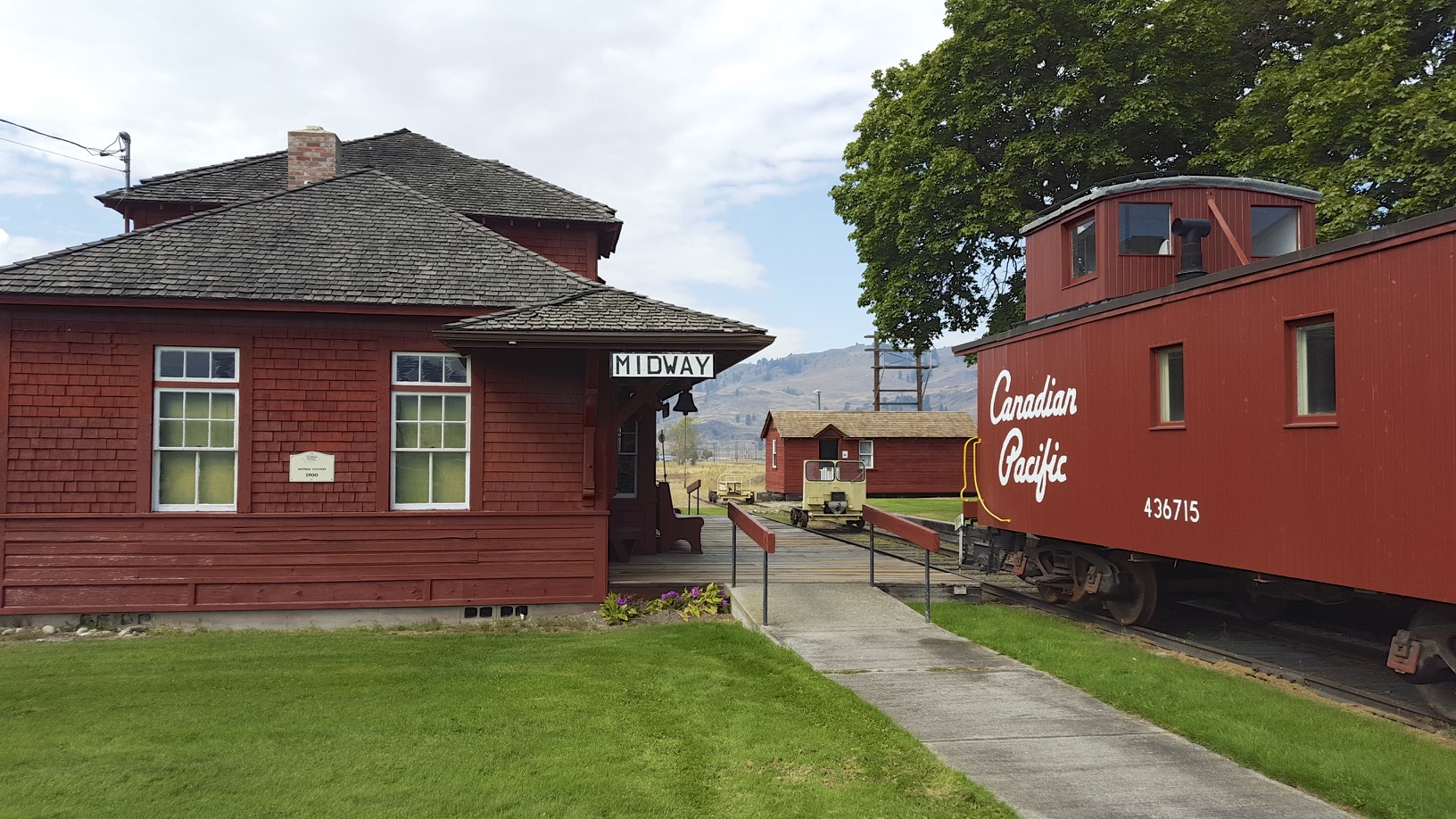
Midway Museum
The museum had excellent historic artifacts from around the area, and lots of KVR related items.
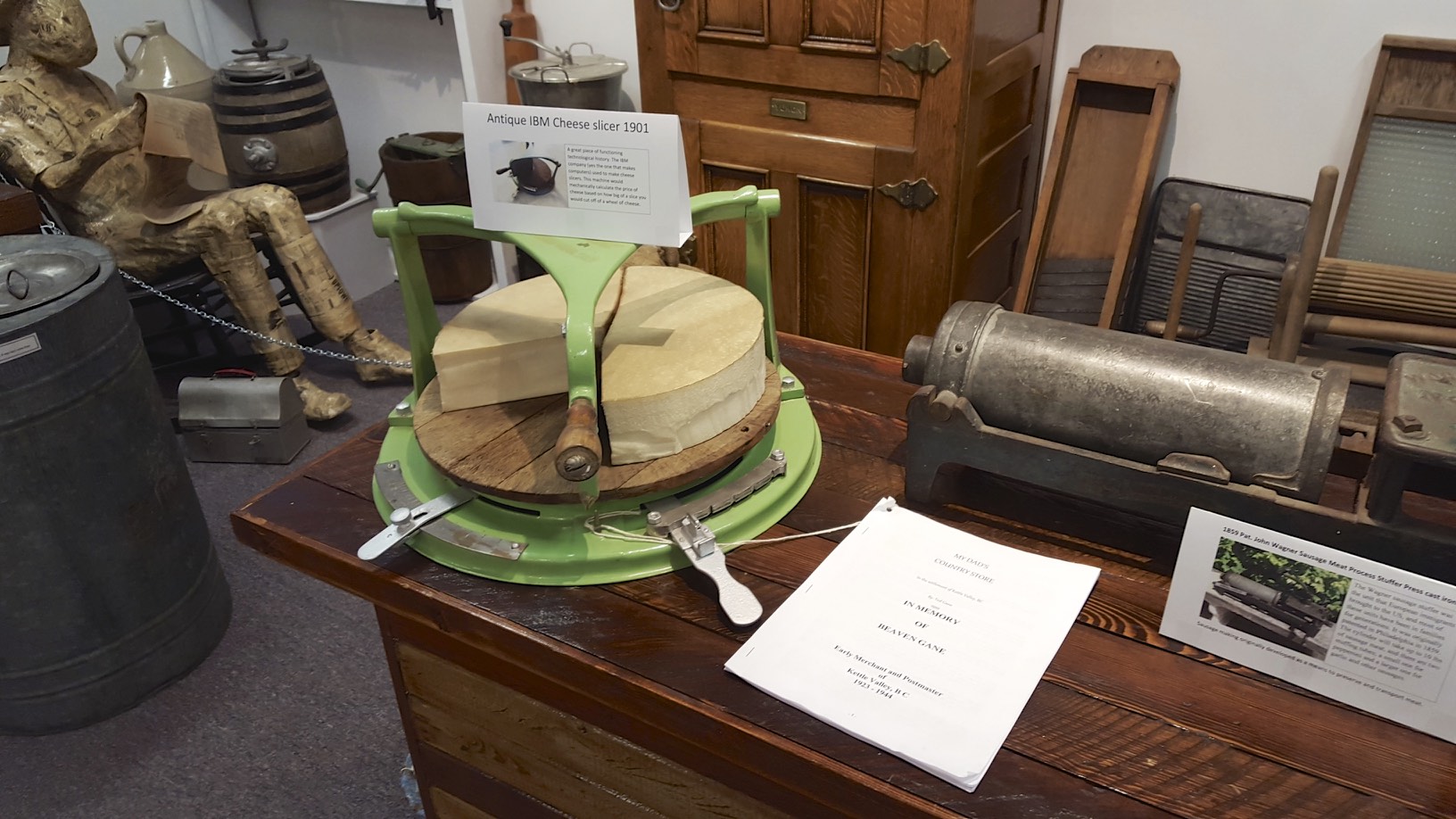
IBM Cheese Slicer
One of the more interesting items was an IBM cheese slicer. The things people had to do before computers.
This was the first day the trail was so rough that I diverted off in places to the highway. I took the trail out of Midway, but after a few KM’s the trail became very rough and overgrown. Since at this point the highway parallels the rail grade, it was much faster and more comfortable to take the highway. When I attempted to rejoin the trail a bit further down, a large section was closed due to the forest fires that had recently gone through around Rock Creek. For about the first half of the trip I ended up sticking to the highway. It’s worth noting that the rail trail and highway follow the Kettle river through this part of the country which the railway was named after.
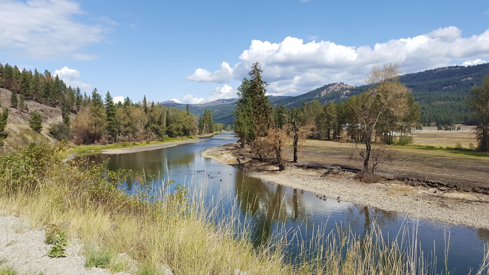
Kettle River
For the first part of the trip, the highway grades were quite reasonable as I was able to make 20-25KM/h in most sections. As the day progressed, the difference between a rail trail and a highway was quite evident. Highways generally go over obstacles, whereas railways typically go through them. Every single ridge in the landscape the highway went over, so you could have a steep 4% climb up a 20 meter ridge, followed by a quick descent. Around Rhone I decided I had enough of the highway and it was time to try the rail trail again, luckily the grade was in good condition from Rhone to Beaverdell.
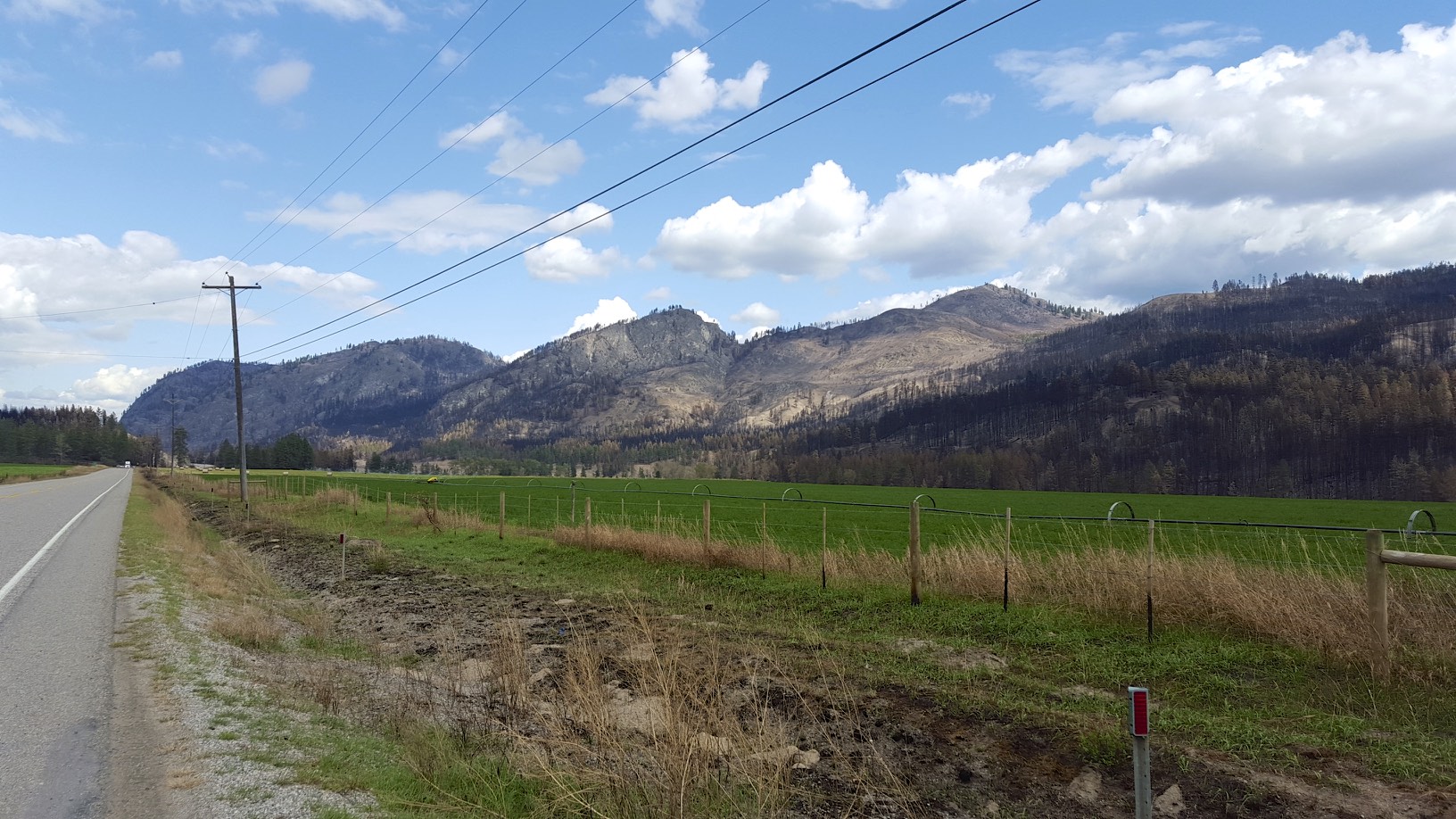
View of the landscape from the highway
Kettle River
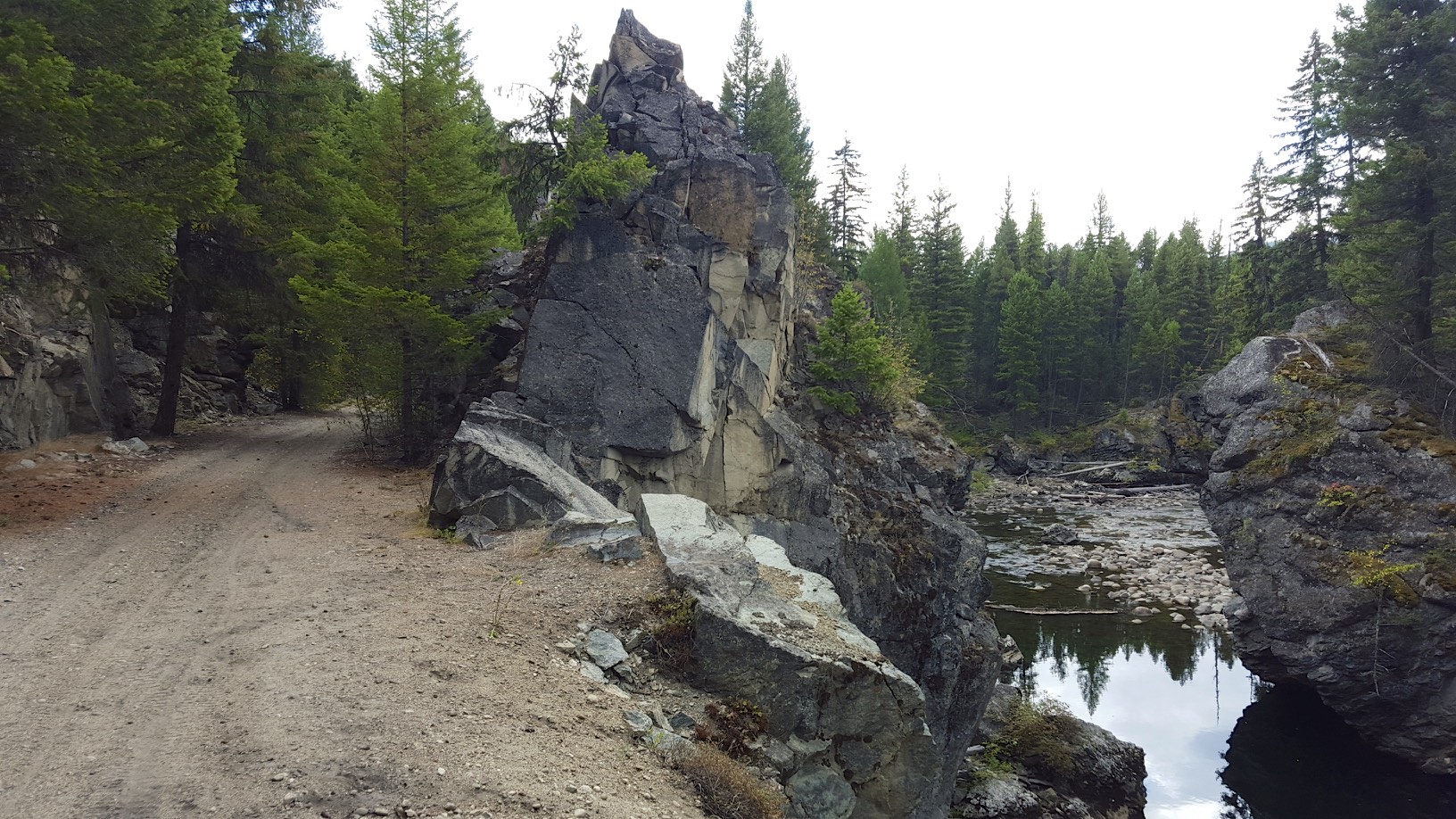
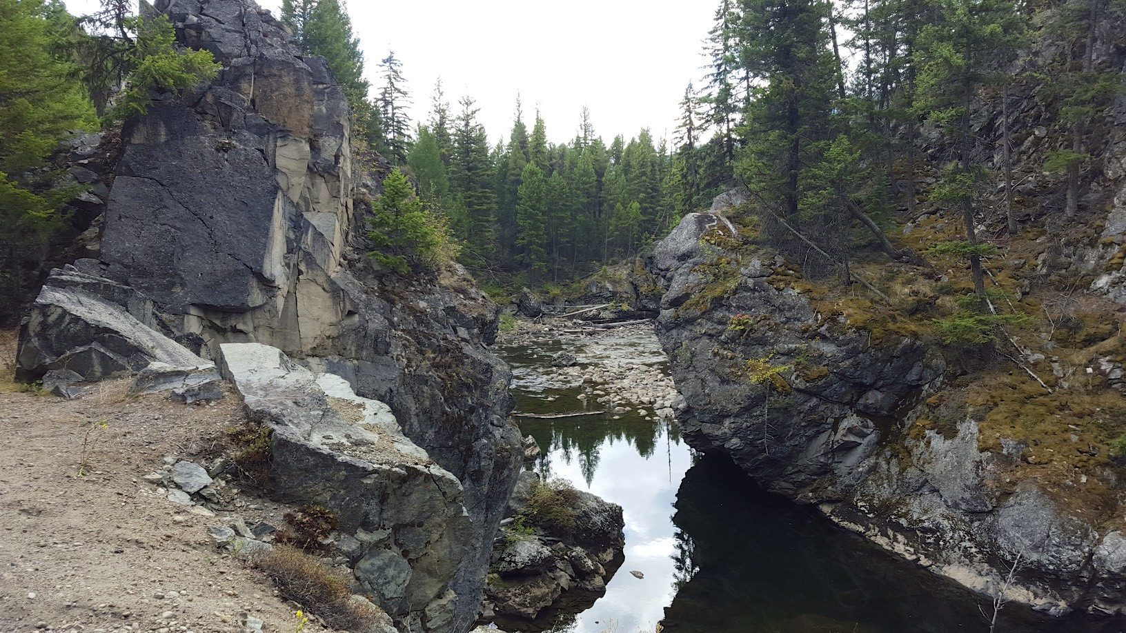
Impressive Rock Cut
For a highway, going over a rocky section like that is cheap and perfectly acceptable. However a train can’t negotiate steep grades like that, so they instead blasted the rock out of the way. As a cyclist, I greatly appreciate going through a rock cut rather than biking over the rocks.
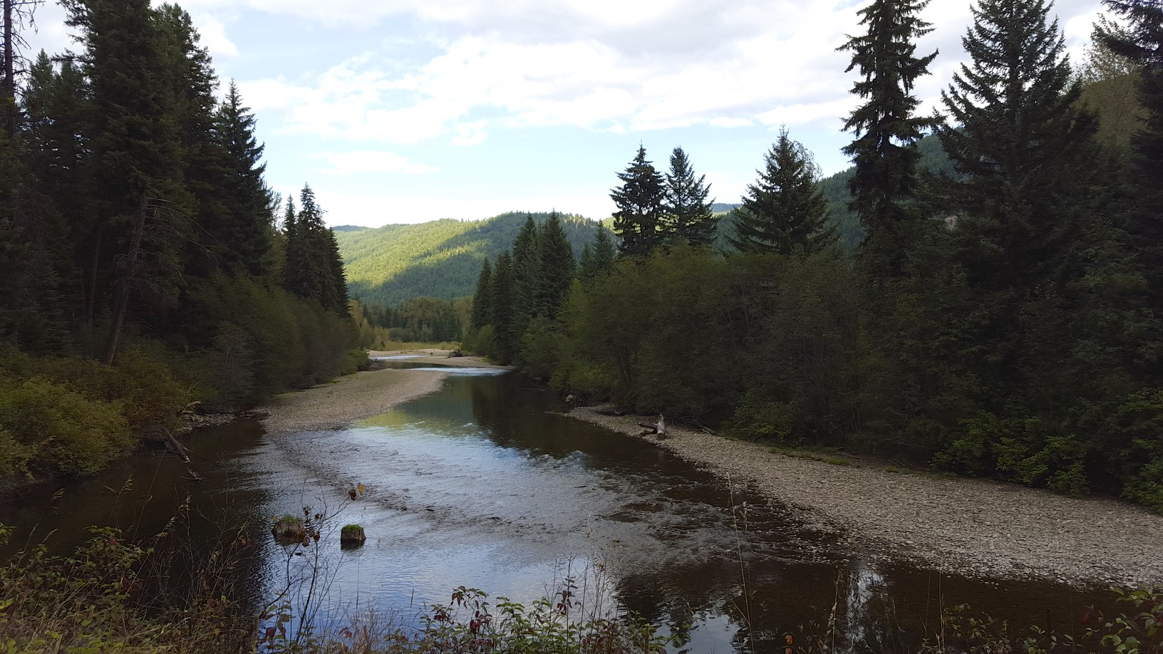
Another view of the Kettle River
As the trail approached Beaverdell, a land owner put up quite the ATV barrier:
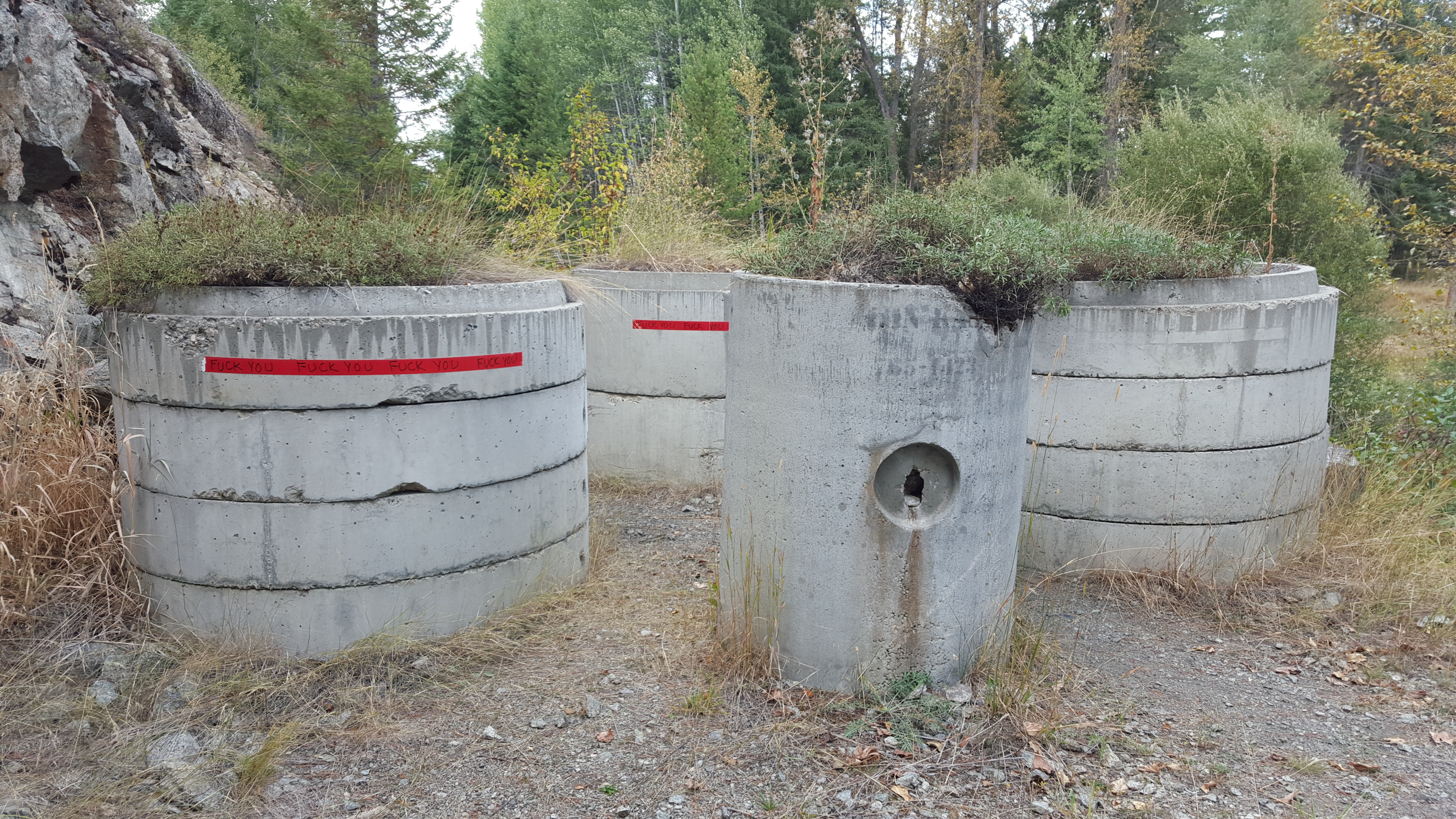
ATV Barrier
I’m not quite sure how they moved those on to the trail, but needless to say no motorized vehicles could get through that. My bike with saddle bags barely fit through with 5 or 10MM to spare. For added effect, the reflective strips in red had “fuck you” written on them. About a 100 feet past the cement barriers there was a barbed wire fence without a gate. At this point on the trail there is no easy bypass route, the highway is on the opposite side of the Kettle River and the accesses were very far away. After biking 68KM I didn’t feel like tracking back for 10 or 20KM to find a detour route. In the end I had to go down a 6 foot embankment off the rail grade, go through an open gate on someone’s property, and climb 6 feet back up on to the rail grade. I have no idea who actually owns the trail in some of these spots, so it’s possible they are legally protecting land they own. I think it’s more likely they may own land on either side of the trail, but not the trail itself. In any event it’s unfortunate these barriers exist.